Home » Antique maps » Europe maps >>> » Wales, antique maps

 
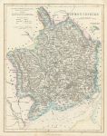
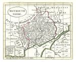
Monmouthshire map, 1844

Monmouthshire map, 1844.
"Monmouthshire" drawn and engraved by F.P.Becker & Co., published in Fisher's County Atlas ..., about 1844. Detailed steel engraved map with original hand colouring. Good condition. Supplied complete with accompanying double sided page of descriptive text. Size 27 x 34 cms plus margins. Ref G9182

 
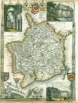
Monmouthshire, Moule, 1850

Monmouthshire, Moule, 1850.
"Monmouthshire" by Thomas Moule, published in James Barclay's Complete and Universal Dictionary ..., about 1850. Decorative steel engraved antique map with recent hand colour. The vignettes show Chepstow Castle, Tintern Abbey and Monmouth Town Hall. Close trimmed to lower and left margins, with slight loss (these maps were very often tightly trimmed by the publishers). Size 20 x 27 cms, plus margins. Ref G7888

 
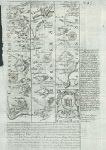
Monmouthshire, Owen/Bowen, c1736

Monmouthshire, Owen/Bowen, c1736.
"Monmouthshire" by Emanuel Bowen published by John Owen between 1720 and 1764. Details of the road from Monmouth to Lanbeder are contained in the cartouche above the map. The reverse shows a route from Monmouth through Abervagenny. Copper engraved map with recent hand colour. Size 12 x 18.5 cms plus margins. Ref G7887


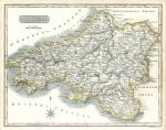
South Wales map, 1784

South Wales map, 1784.
"A New Map of South Wales, Drawn from the latest Authorities" by Thomas Conder, published in Walpoole's New and Complete British Traveller, about 1784. Copper engraved map, with recent hand colouring. Upper border close trimmed, otherwise good condition. Size 34.5 x 22 cms including title, plus margins. Ref G7477

 
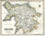
North Wales map, 1784

North Wales map, 1784.
"A New & Correct Map of North Wales, Drawn from the Best Authorities" by Thomas Conder, published in Walpoole's New and Complete British Traveller, about 1784. Copper engraved map, with recent hand colouring. Good condition. Size 34.5 x 22 cms including title, plus margins. Ref G7476

 
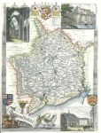
Monmouthshire, Moule, c1850

Monmouthshire, Moule, c1850.
"Monmouthshire" by Thomas Moule, published in James Barclay's Complete and Universal Dictionary ..., about 1850. Decorative steel engraved antique map with recent hand colour. The vignettes show Chepstow Castle, Tintern Abbey and Monmouth Town Hall. Close trimmed to lower and left margins, no loss (these maps were very often tightly trimmed by the publishers). Size 20 x 27 cms, plus margins. Ref G262


Wales, Milford Haven chart, 1856

Wales, Milford Haven chart, 1856.
"Milford Haven" engraved by J.Bartholomew, published by A. Fullarton & Co. in Gazetteer of the World, 1856. Small inset plan of Pembroke Dock. Lithographic map, with original hand colour. Size 23.5 x 14 cms plus margins. Ref F9577

 
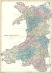
Wales, large map, 1856

Wales, large map, 1856.
"Wales" by J.Bartholomew, published in Black's General Atlas, 1856. Very detailed lithographic map with original hand colouring. Centrefold as published, good condition. Size 42 x 60 cms plus margins. Ref F8960

 
Monmouthshire map, 1786

Monmouthshire map, 1786.
"Monmouthshire" published by Francis Grose in his Antiquities of England and Wales, 1786. Originally drawn, engraved and published by John Seller around 1695, this re-issue by Grose has Seller's name removed. Printed on the top half of a page, the rest of which (and the reverse) carries a historical description of the county in letterpress. Copper engraved map with original hand colour. Good condition with plate mark and wide margins. Map size 15 x 12.5 cms plus wide margins. Ref F7687


South Wales, 1819

South Wales, 1819.
"South Wales" engraved by Neele, published in The New British Traveller, 1819. Copper engraved map with recent hand colour. Good condition Size 25 x 19.5 cms plus margins. Ref F6478

 
North Wales, 1819

North Wales, 1819.
"North Wales" engraved by Neele, published in The New British Traveller, 1819. Copper engraved map with recent hand colour. Good condition Size 25 x 20 cms plus margins. Ref F6477

 
Monmouthshire, Plan of Tintern Abbey, 1848

Monmouthshire, Plan of Tintern Abbey, 1848.
"Ground Plan of Tintern Abbey Church &c. 1845" by Joseph Potter, published by Day & Son, about 1848. Lithographic plan. Good condition. Size 43.5 x 26 cms, plus margins. Ref F4871


Wales, north & south, 1819

Wales, north & south, 1819.
"North Wales" and "South Wales" engraved by Neele, published in The New British Traveller, 1819. pair of copper engraved maps with recent hand colour. Upper margin of North wales map trimmed to neatline, and right margin of South Wales close trimmed. Size 25 x 19.5 cms each, plus margins. Ref F4678

 
Wales, route map with Carmarthen & Cardigan, 1764

Wales, route map with Carmarthen & Cardigan, 1764.
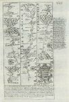
[ Route map with Carmarthen & Cardigan ] by Emanuel Bowen after the earlier survey by John Ogilby, and published by John Owen in Britannia Depicta ..., 1764. On the verso is a contibuation of the route through Llambeder to Aberystwyth. Copper engraved map, close cropped to upper left side. Size 12 x 18 cms plus margins. Ref F3932

 
Wales, route map with Prestain, New Radnor, Builth and on into Carmarthenshire, 1764

Wales, route map with Prestain, New Radnor, Builth and on into Carmarthenshire, 1764.
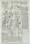
[ Route map with Prestain, New Radnor, Builth and on into Carmarthenshire ] by Emanuel Bowen after the earlier survey by John Ogilby, and published by John Owen in Britannia Depicta ..., 1764. On the verso is a route from Llandovery to Carmarthen. Copper engraved map. Size 12 x 18 cms plus margins. Ref F3928


Wales, route map from Bala to Holywell, 1764

Wales, route map from Bala to Holywell, 1764.
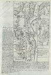
[ Route map Bala to Holywell ] by Emanuel Bowen after the earlier survey by John Ogilby, and published by John Owen in Britannia Depicta ..., 1764. On the verso is a description of Exeter. Copper engraved map, creasing to upper right corner. Size 12 x 18 cms plus margins. Ref F3917

 
Wales, route map with Talabont, Machynlleth & Aberangell, 1764

Wales, route map with Talabont, Machynlleth & Aberangell, 1764.
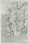
[ Route map with Talabont, Machynlleth & Aberangell ] by Emanuel Bowen after the earlier survey by John Ogilby, and published by John Owen in Britannia Depicta ..., 1764. On the verso is part of a route through Cardiganshire. Copper engraved map, creasing to upper left corner. Size 12 x 18 cms plus margins. Ref F3916

 
Radnor & Brecknockshire, route map with Llanbadervawr, Bealt & Brecon, 1764

Radnor & Brecknockshire, route map with Llanbadervawr, Bealt & Brecon, 1764.
[ Route map with Llanbadervawr, Bealt & Brecon ] by Emanuel Bowen after the earlier survey by John Ogilby, and published by John Owen in Britannia Depicta ..., 1764. On the verso is part of a route through Montgomeryshire. Copper engraved map, creasing to upper left corner. Size 12 x 18 cms plus margins. Ref F3914

 
« Previous | 1 | 2 | 3 | 4 | 5 | 6 | Next »


© 2003 - 2020 Website copyright Steve Bartrick
Royalty free stock images of antique prints of interest to historians, students and family history researchers