Home » Antique maps » Physical and thematic antique maps

 
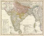
India, Pakistan and Bangladesh, Ethnographic, 1855

India, Pakistan and Bangladesh, Ethnographic, 1855.
"Volker-Karte der Indischen Welt" (ethnographic map of India, including dialects, languages, and ethnicities) published in Dr. Heinrich Berghaus' Physikalischer Atlas, Gotha, 1855 (map dated 1852.) Fine steel engraved map with original hand colour, coded to the keys in the sea areas. Slight age browning around edges, otherwise good condition with plate mark and good margins. Centre-fold as published. Size 41 x 32 cms. Ref E3795

 
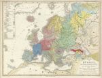
Europe, Ethnographic, 1855

Europe, Ethnographic, 1855.
"Uberlicht von Europa mit Ethnograph ..." (Ethnographic map of Europe) published in Dr. Heinrich Berghaus' Physikalischer Atlas, Gotha, 1855 (map dated 1855.) Fine steel engraved map with original hand colour, coded to the key upper left. Slight age browning around edges, crease and closed tear just to neatline upper right, otherwise good condition with plate mark and good margins. Centre-fold as published. Size 42 x 31.5 cms. Ref E3789

 
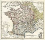
France, language distribution, Berghaus, 1852

France, language distribution, Berghaus, 1852.
" Sprachkarte von Frankreich " (Language map of France) published in Dr. Heinrich Berghaus' Physikalischer Atlas, Gotha, 1852 (map dated 1852.) Fine steel engraved map with original hand colour. Detail showing part of the map. Age browning and slight staining around edges, otherwise very good condition with plate mark and good margins. Centre-fold as published. Size 36 x 30 cms. Ref E598


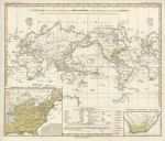
The World, Germanic peoples, Berghaus, 1852

The World, Germanic peoples, Berghaus, 1852.
" Planiglob zur Ubersicht der Verbreitung der Deutschen in beiden Hemispharen uber ganzen Erboden " (ethnographic map showing the spread of Germanic people) published in Dr. Heinrich Berghaus' Physikalischer Atlas, Gotha, 1852 (map dated 1852.) Fine steel engraved map with original hand colour. Detail showing part of the United States inset. Age browning and slight staining around edges, otherwise very good condition with plate mark and good margins. Centre-fold as published. Size 37 x 29.5 cms. Ref E595

 
The World, Indo-German peoples, Berghaus, 1852

The World, Indo-German peoples, Berghaus, 1852.
" Planiglob zur Ubersicht der Verbreitung der Indo-Germanen und Semiten uber gesammte Erdflache " (ethnographic map showing the spread of Indo-Germanic people) published in Dr. Heinrich Berghaus' Physikalischer Atlas, Gotha, 1852 (map dated 1852.) Fine steel engraved map with original hand colour. Detail showing part of the map. Age browning and slight staining around edges, otherwise very good condition with plate mark and good margins. Centre-fold as published. Size 37 x 29.5 cms. Ref E594

 
The World, Distribution of Rodents and Ruminantia, 1850

The World, Distribution of Rodents and Ruminantia, 1850.
" Geographical Division & Distribution of Mammiferous Animals, of the Orders Rodentia & Ruminantia " (rodents & ruminants) engraved by W. & A.K. Johnston, published by William Blackwood & Sons in Johnston's Physical Atlas, 1850. Steel engraved map with original hand colour. Detail showing North America. Slight foxing, otherwise good condition with plate mark and wide margins. Size 26 x 20.5 cms. Ref D8854


The World, Distribution of Mammals, Johnston Physical Atlas, 1850

The World, Distribution of Mammals, Johnston Physical Atlas, 1850.
" Geographical Division & Distribution of Mammiferous Animals of the Orders Quadrumana, Edentata, Marsupialia & Pachydermata " (monkeys, marsupials, toothless animals and thick skinned animals) engraved by W. & A.K. Johnston, published by William Blackwood & Sons in Johnston's Physical Atlas, 1850. Steel engraved map with original hand colour. Detail showing Africa.. Good condition with plate mark and wide margins. Size 20 x 26.5 cms. Ref D8852

 
American River Systems, Johnston Physical Atlas, 1850

American River Systems, Johnston Physical Atlas, 1850.
" The River Systems of America showing ... the River Basins ... " by A.K.Johnston FRGS, engraved by W. & A.K. Johnston, published by William Blackwood & Sons in Johnston's Physical Atlas, 1850. Steel engraved map with original hand colour. Detail showing part of North America. Good condition with wide margins. Size 26 x 20 cms. Ref D6707

 
Old World Mountain Chains, Johnston Physical Atlas, 1850

Old World Mountain Chains, Johnston Physical Atlas, 1850.
" The Mountain Chains of Europe and Asia " engraved by W. & A.K. Johnston, published by William Blackwood & Sons in Johnston's Physical Atlas, 1850. Steel engraved map with original hand colour. Detail showing part of the map. Good condition with wide margins. Size 26 x 20.5 cms. Ref D6056


The World, hydrographic, 1866

The World, hydrographic, 1866.
" Carte Hydrographique des Parties Connues de la Terre ... " engraved by Pepin-Malherbe and published in Chasseloup-Laubat's Atlas des Colonies Francaises, Paris, 1866. Steel engraved map, with original hand colour in blue to the French colonies. Centrefold as published, good condition with wide margins. Size 42 x 27.5 cms. Ref D6055

 
The New World, distribution of animals, Berghaus, 1852

The New World, distribution of animals, Berghaus, 1852.
" Verbreitung der Vorzuglicheren Saugethiere in der Neuen Welt " published in Dr. Heinrich Berghaus' Physikalischer Atlas, Gotha, 1852 (map dated 1851.) Fine steel engraved map with original hand colour, indicating the distribution of certain animal species throughout the Americas. Inset maps showing Austria, the East Indies and vertical section of the Andes. Slight age browning in margins. Centre-fold as published. Size 41 x 34 cms. Ref D1504

 
The Old World, distribution of animals, Berghaus, 1852

The Old World, distribution of animals, Berghaus, 1852.
" Verbreitung der Vorzuglicheren Saugethiere der Alten Welt " published in Dr. Heinrich Berghaus' Physikalischer Atlas, Gotha, 1852 (map dated 1851.) Fine steel engraved map with original hand colour, indicating the distribution of certain animal species throughout the Old World. Detail showing India. Slight age browning in margins. Centre-fold as published. Size 42 x 34 cms. Ref D1503


Europe rainfall chart, Berghaus Physik Atlas, 1852

Europe rainfall chart, Berghaus Physik Atlas, 1852.
" Karte von Eüropa zur Übersicht der Regen-Verhältnisse in diesem Erdtheite " (regions of winter and summer heat and cold) published in Dr. Heinrich Berghaus' Physikalischer Atlas, Gotha, 1852 (map dated 1841 and 1852.) Fine steel engraved map with original hand colour. Very good condition. Centre-fold as published. Size 36 x 30 cms. Ref D567

 
Europe, Isotherm Curves, Humbolt/Berghaus Physik Atlas, 1852

Europe, Isotherm Curves, Humbolt/Berghaus Physik Atlas, 1852.
" Karte von Eüropa, zur Ubersicht der Wärme-Verbreitung in diesen Erdtheile " published in Dr. Heinrich Berghaus' Physikalischer Atlas, Gotha, 1852 (map dated 1837 and 1849.) Fine steel engraved map with original hand colour. Isotherms marked against temperature scales to left and right borders. Slight age browning around edges and very slight foxing. Centre-fold as published. Size 40 x 33 cms. Ref D556


« Previous | 1 | 2 | 3 | 4 | 5 | 6 | 7 | Next »


© 2003 - 2020 Website copyright Steve Bartrick
Royalty free stock images of antique prints of interest to historians, students and family history researchers