Home » Antique maps » Europe maps >>> » Germany, antique maps

 
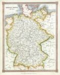
Germany, about 1845

Germany, about 1845.
" German States " engraved by Alex Findlay and published by Thomas Kelly in A New and Complete System of Universal Geography ..., London, about 1840. Steel engraved map with recent hand colouring. Size 19.5 x 25 cms. Ref D8634

 
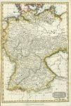
Germany map, 1815

Germany map, 1815.
" Germany " anon, published by Thomas Kelly about 1815. Copper engraved map with recent hand colour. Detail showing part of the map. Two (flattened) horizontal folds as published, otherwise good condition. Size 24.5 x 36 cms. Ref D8592

 
Germany, published about 1778

Germany, published about 1778.
" A New and Correct Map of Germany " by Thomas Bowen(?) and published in Thomas Bankes's New .. System of Universal Geography, London, about 1788. Copper engraved map with recent hand colour. Detail showing the Berlin area.. Slight age browning. Plate mark and good margins. Size 28 x 20 cms. Ref D7314


Germany, Ostells New General Atlas, 1813

Germany, Ostells New General Atlas, 1813.
" Germany " drawn and engraved by J.C.Russell, published in Ostell's New General Atlas, 1813. Copper engraved map with original hand colour. Detail showing part of the map. Slightly grubby and ink blot upper left, plate mark and good margins. Size 22.5 x 19 cms. Ref D6793

 
Germany map,  1842

Germany map, 1842.
" Allemagne " published in Dufour and Picquet's Atlas Classique et Universal de Geographie, Paris, 1842. Detail showing part of the map. Steel engraved map with intricate original hand colour to show all the states, centrefold as published and good margins. Size 37 x 30.5 cms. Ref D5788

 
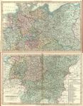
Germany map on 2 sheets, 1824

Germany map on 2 sheets, 1824.
"Germany" anonymous engraver, published in Smith's New General Atlas, 1824 (maps dated 1820). Pair of large (double page) copper engraved maps with original hand colour, designed such that they will fit together to form one large map. Detail showing the Hamburg area. Very slightly soiled and each map has a closed split to the lower few cms of the centrefold (without loss). Size of each map 58 x 36 cms. (Note - the browning down the centrefold of the lower map is much less noticeable than it appears in my scan.) Ref D3517

 
« Previous | ...10 | 11 | 12 | Next »


© 2003 - 2020 Website copyright Steve Bartrick
Royalty free stock images of antique prints of interest to historians, students and family history researchers