Home » Antique maps » America, antique maps

 
Mississippi Delta & Leeward Islands map, 1886

Mississippi Delta & Leeward Islands map, 1886.
"Delta of the Mississippi & Environs of New Orleans" with "Leeward Islands" by J.Bartholomew, published by the Royal Geographical Society in Gazetteer of the World, 1886. Colour lithographic map. Good condition. Size 24.5 x 14.5 cms plus margins. Ref H31

 
Jamaica map, 1886

Jamaica map, 1886.
"Jamaica" published by the Royal Geographical Society in Gazetteer of the World, 1886. Colour lithographic map. Good condition. Size 24.5 x 14 cms plus margins. Ref H27

 
Trinidad map, 1886

Trinidad map, 1886.
"Island of Trinidad" published by the Royal Geographical Society in Gazetteer of the World, 1886. Colour lithographic map. Good condition. Size 23 x 14 cms plus margins. Ref G9960


West Indies map, 1886

West Indies map, 1886.
"West Indies" by J.Bartholomew, published by the Royal Geographical Society in Gazetteer of the World, 1886. Colour lithographic map. Good condition. Size 24 x 15 cms plus margins. Ref G9957

 
Brazil, Province of Rio De Janeiro, 1886

Brazil, Province of Rio De Janeiro, 1886.
"Province of Rio De Janeiro, Brazil" after a map by H.Mahlmann, published by the Royal Geographical Society in Gazetteer of the World, 1886. Colour lithographic map. Good condition. Size 23.5 x 14 cms plus margins. Ref G9838

 
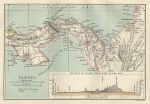
Panama map, 1886

Panama map, 1886.
"Panama" by J.Bartholomew, published by the Royal Geographical Society in Gazetteer of the World, 1886. Colour lithographic map. Good condition. Size 20.5 x 14 cms plus margins. Ref G9782


Boston Harbour map, 1886

Boston Harbour map, 1886.
"Boston Harbour and Vicinity" by J.Bartholomew, published by the Royal Geographical Society in Gazetteer of the World, 1886. Colour lithographic map. Good condition. Size 23.5 x 14 cms plus margins. Ref G9714

 
Brazil map, 1886

Brazil map, 1886.
"East Coast of Brazil; Bahia, Sergipe, Alagoas and part of Pernambuco" by J.Bartholomew, published by the Royal Geographical Society in Gazetteer of the World, 1886. Colour lithographic map. Good condition. Size 14 x 23 cms plus margins. Ref G9713

 
Chile map, 1886

Chile map, 1886.
"Chile" by J.Bartholomew, published by the Royal Geographical Society in Gazetteer of the World, 1886. Colour lithographic map. Good condition. Size 23.5 x 14.5 cms plus margins. Ref G9710


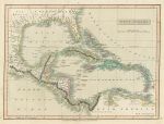
West Indies map, Smith's Atlas, 1808

West Indies map, Smith's Atlas, 1808.
"West Indies" anonymous engraver, published in C.Smith's New General Atlas, 1808. Copper engraved map with full original hand colour. Very good condition. Size 35 x 26 cms plus good margins with partial plate mark. Ref G9589

 
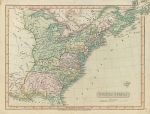
United States map, Smith's Atlas, 1808

United States map, Smith's Atlas, 1808.
"United States" anonymous engraver, published in C.Smith's New General Atlas, 1808. Copper engraved map with full original hand colour. Slight soiling and upper right corner trimmed, otherwise very good condition. Size 35.5 x 27 cms plus good margins with partial plate mark. Ref G9577

 
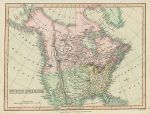
North America map, Smith's Atlas, 1808

North America map, Smith's Atlas, 1808.
"North America" engraved by B.Smith, published in C.Smith's New General Atlas, 1808. Copper engraved map with full original hand colour. Very slight soiling in lower margin, otherwise very good condition. Size 35.5 x 27 cms plus good margins with partial plate mark. Ref G9576


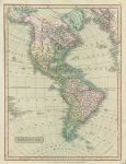
America map, Smith's Atlas, 1808

America map, Smith's Atlas, 1808.
"America" anonymous engraver, published in C.Smith's New General Atlas, 1808. Copper engraved map with full original hand colour. Slight soiling in lower right margin and two fox marks in Atlantic area, otherwise very good condition. Size 35.5 x 27 cms plus good margins with partial plate mark. Ref G9575

 
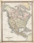
North America map, 1836

North America map, 1836.
"North America" drawn and engraved by Alexander Findlay, published by Thomas Kelly about 1836. Steel engraved antique map with recent hand colour. Slight foxing in the margins, otherwise good condition. Size 20 x 25.5 cms. Ref G9459

 
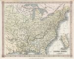
United States map, 1836

United States map, 1836.
"United States" drawn and engraved by Alexander Findlay, published by Thomas Kelly about 1836. Steel engraved antique map with recent hand colour. Good condition. Size 24.5 x 19.5 cms. Ref G9457


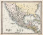
Mexico & Guatemala map, 1836

Mexico & Guatemala map, 1836.
"Mexico & Guatemala" drawn and engraved by Alexander Findlay, published by Thomas Kelly about 1836. Steel engraved antique map with recent hand colour. Good condition. Size 24.5 x 19.5 cms. Ref G9456

 
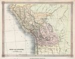
Peru & Bolivia map, 1836

Peru & Bolivia map, 1836.
"Peru & Bolivia" drawn and engraved by Alexander Findlay, published by Thomas Kelly about 1836. Steel engraved antique map with recent hand colour. Good condition. Size 25 x 19.5 cms. Ref G9455

 
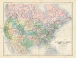
United States and Canada, 1879

United States and Canada, 1879.
"United States and Canada" by A.K.Johnston, published by W. & A.K.Johnston in their Atlas of General and Descriptive Geography, about 1879. Colour lithographic antique map, with centrefold as published. Very slight foxing, otherwise good condition. Size 31 x 23.5 cms including title, plus margins. Ref G8994

 
« Previous | ...10 | 11 | 12 | 13 | 14 | 15 | 16 | 17 | 18 | 19 | 20... | Next »


© 2003 - 2020 Website copyright Steve Bartrick
Royalty free stock images of antique prints of interest to historians, students and family history researchers