Home » Antique maps » World and other maps

 
Cosmography, 1839

Cosmography, 1839.
"Tableau Analitique des Differens Systemes du Monde, par Delamarche ..." steel engraved antique map published in Atlas de la Geographie ..., 1839 (dated 1838). Centrefold as published, good condition. Size 44 x 28 cms plus margins. Ref H1028

 
Pacific Ocean with many Islands (2 maps), 1877

Pacific Ocean with many Islands (2 maps), 1877.
"Polynesien und der Grosse Ocean ..." by C.Vogel, published in Adolf Stieler's Hand Atlas Uber Alle Theile Der Erde ..., 1877. Pair of very detailed steel engraved antique maps with original hand colour. Insets showing many islands in detail. Centrefolds as published. Good condition. Size 40.5 x 33 cms each, plus margins. Ref H991

 
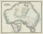
Australia map, 1844

Australia map, 1844.
"Australia with the British Settlements" published in the New Edinburgh General Atlas, 1844. Lithographic antique map with original hand colouring. Good condition. Size 34.5 x 27.5 cms, plus margins. Ref H977


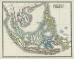
East Indies map, 1844

East Indies map, 1844.
"East India Islands" published in the New Edinburgh General Atlas, 1844. Lithographic antique map with original hand colouring. Good condition. Size 34.5 x 28 cms, plus margins. Ref H976

 
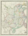
China map, 1844

China map, 1844.
"China" published in the New Edinburgh General Atlas, 1844. Lithographic antique map with original hand colouring. Good condition. Size 27 x 35 cms, plus margins. Ref H975

 
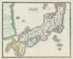
Japan map, 1844

Japan map, 1844.
"Japan" published in the New Edinburgh General Atlas, 1844. Lithographic antique map with original hand colouring. Extremely slight soiling, otherwise good condition. Size 35 x 28.5 cms, plus margins. Ref H973


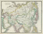
Asia map, 1844

Asia map, 1844.
"Asia" published in the New Edinburgh General Atlas, 1844. Lithographic antique map with original hand colouring. Slight soiling, otherwise good condition. Size 35.5 x 28 cms, plus margins. Ref H875

 
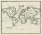
The World on Mercator's Projection, 1844

The World on Mercator's Projection, 1844.
"The World on Mercator's Projection" published in the New Edinburgh General Atlas, 1844. Lithographic antique map with original hand colouring. Some soiling, otherwise good condition. Size 33 x 27.5 cms, plus margins. Ref H873

 
World in Hemispheres, on two sheets, 1844

World in Hemispheres, on two sheets, 1844.
"Western Hemisphere" and "Eastern Hemisphere" published in the New Edinburgh General Atlas, 1844. Pair of lithographic antique maps with original hand colouring. Some soiling and both maps close trimmed to left and right margins (no loss). Size 32 cms diameter each, plus margins. Ref H872


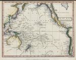
Pacific Ocean on Mecator's Projection, 1811

Pacific Ocean on Mecator's Projection, 1811.
"Pacific Ocean on Mecator's Projection" drawn and engraved by Cooper, published in A System of Modern Geography, 1811 (dated 1809.) Copper engraved antique map with recent hand colouring. Close cropped to upper margin, otherwise good condition. Size 24.5 x 19 cms including title, plus margins. Ref H843

 
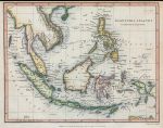
East Indies map, 1811

East Indies map, 1811.
"East India Islands" drawn and engraved by Cooper, published in A System of Modern Geography, 1811 (dated 1809.) Copper engraved antique map with recent hand colouring. Close cropped to upper margin, otherrwise good condition. Size 24 x 19 cms including title, plus margins. Ref H842

 
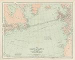
North Atlantic Ocean map, c1869

North Atlantic Ocean map, c1869.
"The North Atlantic and it's Coasts, with the lines of Telegraphic Communication between the Old & New Worlds" chromolithographic map published in an atlas, about 1869. Centrefold as published, good condition. Size 30.5 x 24 cms plus margins. Ref H585


World - Zoological and Plants Charts, 1867

World - Zoological and Plants Charts, 1867.
"Zoological Chart of The World ..." and "Chart of the World shewing the distribution of Principal Plants" by J.Bartholomew, chromolithographic map published in Black's General Atlas of the World ..., 1867. Good condition. Size 25 x 40.5 cms plus margins. Ref H580

 
World - Ocean Currents, and Ethnographic Chart, 1867

World - Ocean Currents, and Ethnographic Chart, 1867.
"Chart of The World Exhibiting it's Chief Physiocal Features, Currents of the Ocean &c." and "Ethnographical Chart of the World..." by J.Bartholomew, chromolithographic map published in Black's General Atlas of the World ..., 1867. Good condition. Size 25 x 41 cms plus margins. Ref H579

 
The World, on Mercator's Projection, 1811

The World, on Mercator's Projection, 1811.
"The World on Mercator's Projection" engraved by Cooper after Alex MacPherson, published in A System of Modern Geography, 1811. Copper engraved antique map with recent hand colouring. Several flattened vertical folds and some creasing, lower margin close trimmed to about 5mm, otherwise good condition. Size 41 x 25 cms including title, plus margins. Ref H252


Java map, 1886

Java map, 1886.
"Java" by A.Petermann, published by the Royal Geographical Society in Gazetteer of the World, 1886. Colour lithographic map. Good condition. Size 25 x 14 cms plus margins. Ref H29

 
Japan map, 1886

Japan map, 1886.
"Japan" published by the Royal Geographical Society in Gazetteer of the World, 1886. Colour lithographic map. Good condition. Size 14.5 x 25 cms plus margins. Ref H28

 
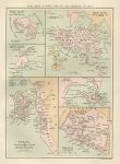
Hong Kong & other British settlements in Asia, 1886

Hong Kong & other British settlements in Asia, 1886.
"Hong Kong & other British settlements in Asia" (Perim Island, Labuan Island, Penang, Aden and Malacca & Nanning) by J.Bartholomew, published by the Royal Geographical Society in Gazetteer of the World, 1886. Colour lithographic map. Good condition. Size 14.5 x 21 cms plus margins. Ref H25

 
« Previous | 1 | 2 | 3 | 4 | 5 | 6 | 7 | 8 | 9 | 10... | Next »


© 2003 - 2020 Website copyright Steve Bartrick
Royalty free stock images of antique prints of interest to historians, students and family history researchers