Home » Antique maps » All prints and maps

 
Europe, Ostells New General Atlas, 1813

Europe, Ostells New General Atlas, 1813.
" Europe " drawn and engraved by J.C.Russell, published in Ostell's New General Atlas, 1813. Copper engraved map with original hand colour. Detail showing part of the map. Some soiling, partial plate mark and good margins. Size 22.5 x 19 cms. Ref D6782

 
South America, Ostells New General Atlas, 1813

South America, Ostells New General Atlas, 1813.
" South America " drawn and engraved by J.C.Russell, published in Ostell's New General Atlas, 1813. Copper engraved map with original hand colour. Detail showing part of the map. Some soiling, full plate mark and good margins. Size 18.5 x 22.5 cms. Ref D6776

 
American River Systems, Johnston Physical Atlas, 1850

American River Systems, Johnston Physical Atlas, 1850.
" The River Systems of America showing ... the River Basins ... " by A.K.Johnston FRGS, engraved by W. & A.K. Johnston, published by William Blackwood & Sons in Johnston's Physical Atlas, 1850. Steel engraved map with original hand colour. Detail showing part of North America. Good condition with wide margins. Size 26 x 20 cms. Ref D6707


France, Garonne Basin, Atlas Universel, 1877

France, Garonne Basin, Atlas Universel, 1877.
" La France Historique, Bassin de la Garonne " engraved by Erhard after Vuillemin, published in Atlas Universel D'Histoire et de Geographie, Paris, 1877. Lithographic map with recent hand colour. Centre-fold as published. Size 26 x 20 cms. Ref D6669

 
Spain & Portugal, historical map, 711-1028 AD, 1880

Spain & Portugal, historical map, 711-1028 AD, 1880.
" Iberische Halbinsel von der Ankunft der Araber bis zum Untergangeder Omaijaden 711 bis 1028 " (arrival of the Arabs up to 1028 AD) by Spruner and Menke, published in the Spruner-Menke Hand-Atlas, Gotha, 1880. Finely detailed steel engraved map with original hand colouring. Inset map showing the period up to 1086 AD. Good condition with plate mark and good margins. Centrefold as published. Size 40 x 33.5 cms. Ref D6513

 
Netherlands, Belgium & Denmark, 1863

Netherlands, Belgium & Denmark, 1863.
" Belgium and the Netherlands " and " Denmark " by A.K.Johnston, colour lithographic map published by William Blackwood in Johnston's School Atlas of General & Descriptive Geography, 1863. Centrefold as published. Size 32 x 25 cms. Ref D6427


Spain & Portugal, 1863

Spain & Portugal, 1863.
" Spain & Portugal " by A.K.Johnston, colour lithographic map published by William Blackwood in Johnston's School Atlas of General & Descriptive Geography, 1863. Centrefold as published with closed tear of 1.5 cms to lower part of fold, just into neatline. Size 24.5 x 30.5 cms. Ref D6423

 
Scandinavia map, 1863

Scandinavia map, 1863.
" Sweden & Norway " by A.K.Johnston, colour lithographic map published by William Blackwood in Johnston's School Atlas of General & Descriptive Geography, 1863. Centrefold as published. Size 23.5 x 30.5 cms. Ref D6422

 
South America, Johnston/Blackwood, 1863

South America, Johnston/Blackwood, 1863.
" South America " by A.K.Johnston, colour lithographic map published by William Blackwood in Johnston's School Atlas of General & Descriptive Geography, 1863. Centrefold as published, slight dampstaining to left side. Size 23.5 x 30.5 cms. Ref D6395


West Indies & Central America, 1863

West Indies & Central America, 1863.
" Central America and the West Indian Islands " by A.K.Johnston, colour lithographic map published by William Blackwood in Johnston's School Atlas of General & Descriptive Geography, 1863. Centrefold as published. Size 31 x 23.5 cms. Ref D6394

 
North America, Johnston/Blackwood General Geography, 1863

North America, Johnston/Blackwood General Geography, 1863.
" North America " by A.K.Johnston, colour lithographic map published by William Blackwood in Johnston's School Atlas of General & Descriptive Geography, 1863. Detail showing the Nebraska area. Centrefold as published. Size 23.5 x 30.5 cms. Ref D6392

 
Asia in several maps, Diderot, 1780

Asia in several maps, Diderot, 1780.
" Nouvelle Representation des Cotes Nord et Est de L'Asie .." by Didier Robert de Vaugondy. Published in the 'Vaugondy Supplement' to Diderot's Encyclopedia, 1772 or 79. Composite of three maps - the largest showing the then current knowledge of the north and east coasts of Asia including Japan. Large inset map is taken from a tracing of a map in Histoire des Tartares by d'Abulgasi-Bayadur Chan, Leyden, 1726. Small inset shown as a reduction of a map published in Nuremburg. Detail showing part of the map. Slightly weak impression. Several folds as published, margins of about 1 cm or more. (Ref: Belle et Utile, Mary Pedley, No. 402.) Size 37.7 x 29.3 cms. Ref D6330


France, with Battles marked, Lavoisne 3rd edn, 1821

France, with Battles marked, Lavoisne 3rd edn, 1821.
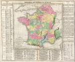
" Geographical and Statistical Map of France ", "divided into Governments indicating the places rendered celebrated by Battles or Sieges " by C.Gross, engraved by J.Yeager, published by M.Carey & Son in A Complete Genealogical, Historical, Chronological and Geographical Atlas .. by M.Lavoisne, third American (Philadelphia) edition, 1821. Various notes and statistics around and below the map. Key to the marked battle and siege sites below the map itself. Detail showing part of the map. Copper engraving with full original hand colour, centre-fold as published. Some browning down centre-fold and slight soiling. Margins of 1 cms or more. Overall size 51 x 41.5 cms. Ref D6116

 
Canada, British Columbia, Cariboo area, RGS Journal, 1864

Canada, British Columbia, Cariboo area, RGS Journal, 1864.
" Reconnaisance Sketch of part of Cariboo by Lieut. H.S.Palmer R.E. " engraved by Edward Weller and published in the Journal of the Royal Geographical Society, 1864. Steel engraved map, on very thin paper. Two folds as published. Good condition. Size 24.5 x 19 cms. Ref D6090

 
Central America, SDUK, 1844

Central America, SDUK, 1844.
" Central America ... " engraved by J. & C. Walker, published by The Society for the Diffusion of Useful Knowledge (SDUK), about 1842. Steel engraved map with original outline hand colour. Detail showing the Mexico City area. Slight age browning. Size 39.5 x 31 cms. Ref D6081


Old World Mountain Chains, Johnston Physical Atlas, 1850

Old World Mountain Chains, Johnston Physical Atlas, 1850.
" The Mountain Chains of Europe and Asia " engraved by W. & A.K. Johnston, published by William Blackwood & Sons in Johnston's Physical Atlas, 1850. Steel engraved map with original hand colour. Detail showing part of the map. Good condition with wide margins. Size 26 x 20.5 cms. Ref D6056

 
The World, hydrographic, 1866

The World, hydrographic, 1866.
" Carte Hydrographique des Parties Connues de la Terre ... " engraved by Pepin-Malherbe and published in Chasseloup-Laubat's Atlas des Colonies Francaises, Paris, 1866. Steel engraved map, with original hand colour in blue to the French colonies. Centrefold as published, good condition with wide margins. Size 42 x 27.5 cms. Ref D6055

 
Sweden & Norway map, 1858

Sweden & Norway map, 1858.
" Sweden and Norway with Russian Finland by G.H.Swanston Edinr. " engraved by G.H.Swanston and published by A.Fullarton & Co. in The Companion Atlas to The Gazetteer of the World, about 1858. Steel engraved map with original hand colour in delicate pastel shades. On thick paper, with plate mark and good margins. Small inset map showing the environs of Stockholm. Detail showing part of the map. Centre-fold as published, good condition. Size 40 x 50 cms. Ref D6034

 
« Previous | ...200 | 201 | 202 | 203 | 204 | 205 | 206 | 207 | 208 | 209 | 210... | Next »


© 2003 - 2020 Website copyright Steve Bartrick
Royalty free stock images of antique prints of interest to historians, students and family history researchers