Home » Antique maps » All prints and maps

 
France between 1789 and 1815, published about 1818

France between 1789 and 1815, published about 1818.
"Carte Comparative del la France et des Etats Voisons en 1789 et 1813" engraved by Chamouin after P.Lapie, copper engraved map with original hand colouring, published in Lapie's Atlas Classique et Universel..., about 1815. Centrefold as published, very good condition, on thick paper with good margins. Size 47.5 x 37 cms plus margins. Ref E4042

 
Ancient Greece, 1818

Ancient Greece, 1818.
"Grece Ancienne" engraved by Chamouin after P.Lapie, copper engraved map with original hand colouring, published in Lapie's Atlas Classique et Universel..., about 1818. Very good condition, on thick paper with good margins. Size 29.5 x 22.5 cms plus margins. Ref E4037

 
Ancient Germany, 1818

Ancient Germany, 1818.
"Germanie Ancienne" engraved by Chamouin after P.Lapie, copper engraved map with original hand colouring, published in Lapie's Atlas Classique et Universel..., about 1818. Very good condition, on thick paper with good margins. Size 31 x 22.5 cms plus margins. Ref E4035


Europe, published about 1818

Europe, published about 1818.
"Europe" engraved by Chamouin after P.Lapie, copper engraved map with original hand colouring, published in Lapie's Atlas Classique et Universel..., about 1818. Centrefold as published, light crease across upper right corner, otherwise very good condition, on thick paper with with good margins. Size 46 x 36.5 cms plus margins. Ref E4034

 
Ancient France, 1818

Ancient France, 1818.
"Carte des Gaules" engraved by Chamouin after P.Lapie, copper engraved map with original hand colouring, published in Lapie's Atlas Classique et Universel..., about 1818. Very good condition, on thick paper with good margins. Size 30 x 22.5 cms plus margins. Ref E4029

 
South America, 1818

South America, 1818.
"Amerique Meridionale .." engraved by Chamouin after P.Lapie, copper engraved map with original hand colouring, published in Lapie's Atlas Classique et Universel..., about 1818. Very good condition, on thick paper with good margins. Size 22.5 x 30 cms plus margins. Ref E4023


Africa, Colony of Algiers, 1818

Africa, Colony of Algiers, 1818.
"Carte del la Colonie D'Alger avec le trace de la Regence de Tunis et del la Partie sept. de L'Empire de Maroc" copper engraved map with original hand colouring, published in Lapie's Atlas Classique et Universel..., about 1818. Centrefold as published, staining in upper margin about 1 cm away from image edge, otherwise good condition, on thick paper with good margins. Size 47 x 36 cms. Ref E4022

 
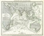
Indian Ocean chart, 1852

Indian Ocean chart, 1852.
"Physikalische Karte vom Inisschen Meere" published in Joseph Meyer's Neuster Zeitungs Atlas..., 1852. Steel engraved map with original hand colouring. Shows the currents, temperatures and other hyrographic details. Very sight age browning, otherwise good condition. Size 25 x 20.5 cms plus margins. Ref E3991

 
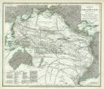
Pacific Ocean chart, 1852

Pacific Ocean chart, 1852.
"Karte von Grossen Ocean ..." published in Joseph Meyer's Neuster Zeitungs Atlas..., 1852. Steel engraved map with original hand colouring. Shows the currents, temperatures and other hyrographic details. Sight age browning, otherwise good condition. Size 26 x 22 cms plus margins. Ref E3990


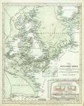
British Isles and North Sea, Tidal Chart, 1852

British Isles and North Sea, Tidal Chart, 1852.
"Karte von dem Deutschen Meere ..." published in Joseph Meyer's Neuster Zeitungs Atlas..., 1852. Steel engraved map with original hand colouring. Sight age browning, otherwise good condition. Size 21.5 x 27.5 cms plus margins. Ref E3989

 
Europe, Distribution of Trees and Bushes, 1852

Europe, Distribution of Trees and Bushes, 1852.
"Verbreitung Der Wichtigsten Kultur, - Baum - Und Strauchgewachse In Europa" published in Joseph Meyer's Neuster Zeitungs Atlas..., 1852. Steel engraved map with original hand colouring. Sight age browning, otherwise good condition with weak plate mark and good margins. Size 27.5 x 20 cms plus margins. Ref E3987

 
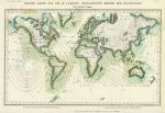
World, magnetic declination, 1852

World, magnetic declination, 1852.
"Magnet-Karte fur die in 4 Jaharen Beobachteten Werthe der Declination" published in Joseph Meyer's Neuster Zeitungs Atlas..., 1852. Steel engraved map with original hand colouring. Sight age browning, otherwise good condition with weak plate mark and good margins. Size 24.5 x 15 cms plus margins. Ref E3984


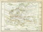
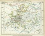
Europe, Isotherms, 1852

Europe, Isotherms, 1852.
"Karte von Europa zur Ubersicht der Warme Verbreitung in diesem Erdtheile" published in Joseph Meyer's Neuster Zeitungs Atlas..., 1852. Steel engraved map with original hand colouring. Very slight age browning and stain upper left, otherwise good condition with weak plate mark and good margins. Size 26 x 19.5 cms plus margins. Ref E3982

 
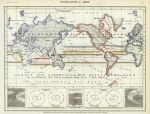
Wind Map of the World, 1852

Wind Map of the World, 1852.
"Windkarte der Erde" published in Joseph Meyer's Neuster Zeitungs Atlas..., 1852. Steel engraved map with original hand colouring. Very slight age browning, otherwise good condition with weak plate mark and good margins. Size 26 x 19.5 cms plus margins. Ref E3981

 
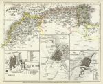
North West Africa, 1852

North West Africa, 1852.
"Marocco, Algier und Tunis, 1849" published in Joseph Meyer's Neuster Zeitungs Atlas..., 1852. Detailed steel engraved map with original hand colour. Inset plans of Marocco, Algier and Constantine (in Algieria). Slight age browning, otherwise good condition with weak plate mark and good margins. Size 26 x 21 cms plus margins. Ref E3976


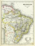
South America, Brazil, 1852

South America, Brazil, 1852.
"Brasilien ..., 1851" published in Joseph Meyer's Neuster Zeitungs Atlas..., 1852. Detailed steel engraved map with original hand colour. Slight age browning and foxing lower right, otherwise good condition with weak plate mark and good margins. Size 19.5 x 25.5 cms plus margins. Ref E3973

 
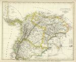
South America, (Colombia, Venezuela, Ecuador), 1852

South America, (Colombia, Venezuela, Ecuador), 1852.
"(Columbia) Neu-Granada, Ecuador und Venezuela, 1849" published in Joseph Meyer's Neuster Zeitungs Atlas..., 1852. Detailed steel engraved map with original hand colour. Mountain heights shown lower right. Slight age browning and foxing, otherwise good condition with weak plate mark and good margins. Size 26 x 20.5 cms plus margins. Ref E3972

 
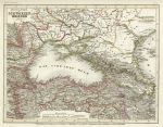
The Black Sea & Caucasus, 1852

The Black Sea & Caucasus, 1852.
".. Schwarzen Meeres, 1850" published in Joseph Meyer's Neuster Zeitungs Atlas..., 1852. Detailed steel engraved map with original hand colour. Slight age browning, otherwise good condition with weak plate mark and good margins. Size 25 x 19 cms plus margins. Ref E3958

 
« Previous | ...190 | 191 | 192 | 193 | 194 | 195 | 196 | 197 | 198 | 199 | 200... | Next »


© 2003 - 2020 Website copyright Steve Bartrick
Royalty free stock images of antique prints of interest to historians, students and family history researchers